


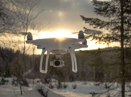
Unmanned airborne vehicle photogrammetry in practice
Presenting person: Oliver Archner, BayCEER IT Service Group (Homepage)Mo. 2024-08-05 (09:00-18:00), tba
Overview
Using drones in a scientific project is a lot more complicated than just taking some images. Beside some basic remote sensing knowledge, you need technical and practical skills to complete a successful flight mission. This course is designed to teach you the basics in one day and gives you all the information to plan and execute your own mission.
Learning Objectives
- Principles of unmanned airborne vehicle (UAV) photogrammetry
- Learn how to plan and execute a drone flight mission
- Understand the raw data processing workflow and its output data
- Analyze data products like ortho and multispectral images
Course Content
- Basics of airborne photogrammetry
- Technical characteristics of drones and optical sensors
- Mission planning
- Flight mission on a forest site next to the UBT campus
- Postprocessing and data analysis
Teaching Style
Classroom teaching and on field site exercises (drone flight mission)
Registration
By e-mail to:oliver.archner@uni-bayreuth.de
Export as iCal:
Upcoming ...
Upcoming ...
| BayCEER Colloquium: |
|---|
| Th. 2024-05-16 Dimethylated thioarsenates: potentially dangerous hidden arsenic species in rice and rice products |
| Dialog: |
| Fr. 2024-05-17 Forum Zukunftswald: Bodenvegetation: Erkennen und deren Bedeutung für den Waldbau |
| Ecological-Botanical Garden: |
| We. 2024-05-15 Kurzführung | "Botanische Mittagspause" |
| Su. 2024-05-19 Führung | "Den ÖBG Kennenlernen: Allgemeine Gartenführung" |
| We. 2024-05-29 Führung | "Grüne Apotheke: Heilpflanzen" |